Contents
Index
Import BLM Data
This Routine will read GMM files containing Public Lands Survey System (PLSS) data from the US Bureau of Land Management.
The following files are used:
The RAW file (filename.raw) containing point data and dimensions of lines
The LX file (filename.lx) containing coordinates after they have been adjusted in GMM
The CON file (filename.con) containing coordinates and details of control points.
The SID file (filename.sid) containing metadata for the lines (surveyor, date of survey etc)
Open a new job and in the job settings set the job units and the job datum and zone
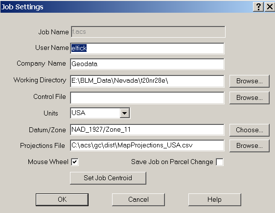
It is important to set these parameters as some of the data may be in geographic format (Latitude/Longitude)
Select Conversions/Import GMM Data and the following dialogue will appear.
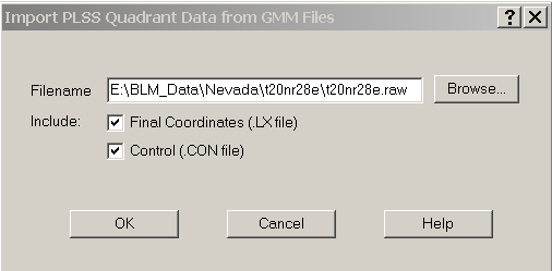
Enter the filename for the RAW file and tick the boxes if you wish to include final coordinates and/or control data.
If the final coordinates box is not ticked, then the job will be initially built from the coordinates in the RAW file.
When you hit OK, a second dialogue box will appear and display the datum and zone used in the selected files
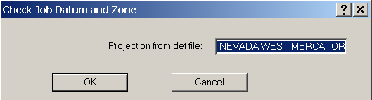
You should check that these match the job settings before proceding.
It will then format the lines into parcels and display them as a joined parcel network
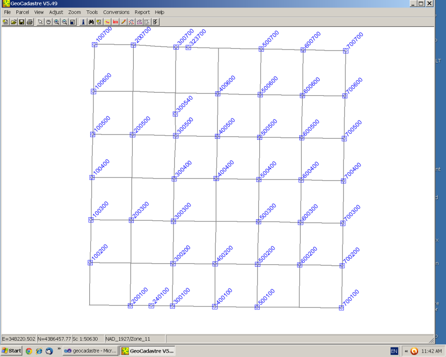
Parcels will be created for the sections with the parcel name being the section number.
Each parcel boundary will be made up from dimensions from the "RAW" file.
Each point will have a local point number and the the six digit point identification number will be stored as the point code.